Cape Sa Vi, Vietnam’s northeastern-most point
 |
| Cape Sa Vi, Vietnam’s northeastern-most point |
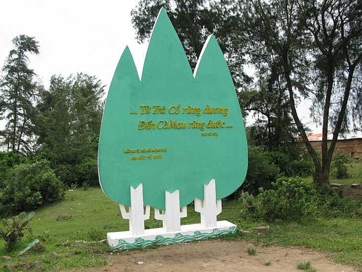
Cape Sa Vi, 350 km from Hanoi, is also called Cape Got, after Dau Got islet. On a sign at the entrance to the cape are three pine branches and a poem by revolutionary poet To Huu called: "From the Tra Co pine forest to the Cà Mau mangroves”.
Ca Mau is Vietnam’s southern-most point. A tourist named Viet told us: "This is the first time I’ve visited Cape Sa Vi. I’m excited and proud of our country because this place is very special.”
The first ray of the sun has reached Sa Vi. The spectacle of the birth of the day on the beach of Tra Co is absolutely magnificent. The beach, shaped like a giant sickle, stretches for seventeen kilometers.
The border information center building, inaugurated in 2009, faces a square with two parallel lines of stone pillars leading to the main hall which is surrounded by stone pillars in a crescent shape.
The stones are from Ninh Binh province. The design depicts a soldier guarding the national border.
 |
Mong Cai town has a second cape – cape Ngoc (Pearl) - which marks one end of Vietnam’s 3,000 km coastline. The other end is Ha Tien in Kien Giang province.
Other popular destinations in Mong Cai city are with Xa Tac temple, Tra Co coastal village, Hai Son-Bac Son mural painting village, and the fishing village on Vinh Thuc island.
Mong Cai authorities are pursuing a tourism strategy that promotes the city’s friendliness, convenience, and reliability. The city has upgraded its infrastructure and tourism facilities.
Nguyen Thi Thanh Huyen, director of a local travel agency, said: "The investment in tourism infrastructure and products have attracted tourists and boosted our business. Since 2014, the number of visitors to the city has increased dramatically."
Mong Cai hopes to welcome 3 million visitors this year and even more in the years to come.
What the stars mean:
★ Poor ★ ★ Promising ★★★ Good ★★★★ Very good ★★★★★ Exceptional
Related Contents
Latest News
More News
- Manila becomes a new check-in destination for Vietnamese youth (December 11, 2025 | 18:07)
- Vietjet launches mega year-end ticket promotion (December 10, 2025 | 11:33)
- Dalat leads Vietnam’s 2025 search trends (December 09, 2025 | 13:44)
- Vietnam welcomes record wave of international visitors (December 09, 2025 | 13:43)
- Vietjet launches daily Manila flights to celebrate year-end festive peak season (December 05, 2025 | 13:47)
- The destinations powering Vietnam’s festive season travel demand (December 04, 2025 | 18:33)
- Vietnam named among the world’s most exciting winter destinations (December 04, 2025 | 15:10)
- Phu Tho emerges as northern Vietnam’s new tourism hub (December 01, 2025 | 17:00)
- Vietjet completes Airbus A320/A321 updates ahead of deadline (December 01, 2025 | 09:49)
- Vietjet resumes Con Dao flights from early December (November 28, 2025 | 15:24)

 Tag:
Tag:


 Mobile Version