Storm Maon further weakens into low pressure area, downpours continue in northern region
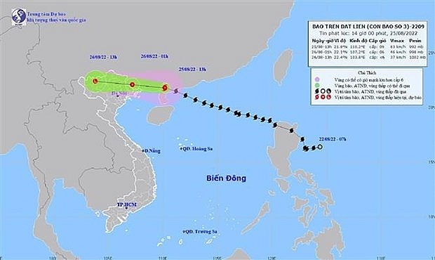
Hanoi - Storm Maon – the third to enter the East Sea this year, further weakened into a low pressure area in the northern mountainous region on early August 26.
 |
| Path of Storm Maon (Photo: VNA) |
At 1am, the strongest wind at the centre of the low pressure area was below 39 km/h. In the next 12 hours, the area will continue to move westward and gradually dissipate.
There is a high risk of flash floods and landslides in mountainous provinces and flooding in low-lying areas such as Quang Ninh, Thai Nguyen, Lang Son, and Bac Giang.
In the capital city of Hanoi, extreme rain hit the capital on August 25 morning, causing rush-hour issues and falling trees. More bad weather is expected in the coming days
Heavy rains are forecast to continue in the northern region and some parts of the central and southern regions during the day.
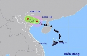
 | Storm Mulan weakens into tropical depression Storm Mulan weakened into a tropical depression after entering the Gulf of Tonkin on August 10 night, according to the National Centre for Hydro-Meteorological Forecasting. |
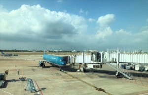
 | Airlines adjust flight plans over storm Mulan In response to impacts of storm Mulan in the Gulf of Tokin, Vietnamese airlines have adjusted operation plans of flights to and from some affected airports from August 11. |
What the stars mean:
★ Poor ★ ★ Promising ★★★ Good ★★★★ Very good ★★★★★ Exceptional
Related Contents
Latest News
More News
- Government launches regular health checks alongside food safety crackdown (April 22, 2026 | 10:18)
- Vietnam recognised among top performers in World Bank human capital index (April 20, 2026 | 20:32)
- VCCI refutes US concerns over overcapacity and forced labour in Vietnam (April 17, 2026 | 17:22)
- Vietnamese among Asia’s most optimistic spenders (April 14, 2026 | 16:49)
- MoH urges hospitals to accelerate electronic medical records (April 13, 2026 | 14:19)
- Hanoi considers easing pickup truck restrictions to support businesses (April 02, 2026 | 15:52)
- Female leadership to steer Vietnam's future (April 02, 2026 | 14:56)
- Hanoi targets rabies elimination as pet meat trade revenues plummet (March 25, 2026 | 10:31)
- Hanoi pilots programme to phase out dog and cat meat trade (March 23, 2026 | 09:29)
- Vietnam performs first domino multi-organ transplant (March 20, 2026 | 09:00)

 Tag:
Tag:


 Mobile Version