Vietnam uses satellite to search for missing plane

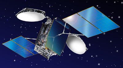
VNRedsat-1 satellite China has deployed 10 satellites to provide navigation, communication and support services for search crews.
Chu Xuan Huy, from Vietnam Academy of Science and Technology, said the VNDRedsat-1 was above Tho Chu Island at around 11am this morning. The satellite took pictures in an area of 17.5 kilometres wide and 80-260 kilometres long. The satellite was able to capture images of the area for around one hour and the centre will receive the photos of Tho Chu Island this evening.
The Deputy Chief of the General Staff of the Vietnam People's Army Lieutenant General, Vo Van Tuan, said they had asked provincial authorities to carry out searches on land this morning. The search was carried out along the original flight path across Hon Khoai Island to HCM City, and now will be expanded on both sides.
In case the craft is found underwater, Vietnam has several ships capable of carrying out such a mission. "If the plane is underwater, we'll notify the Malaysian authorities immediately and jointly salvage the plane," Tuan said.
China has asked permission to send two aircraft into Vietnamese airspace. Meanwhile, several countries, such as UK, France and Australia have also offered to join the search for the missing plane. Singapore is seeking permission to bring in a device to detect the pinging from a black box.
At 1:15pm, a search crew spotted a white object floating 80 nautical miles off Tho Chu Island. Two helicopters from China and Vietnam are searching for the object.
Currently, the chairman of Phu Quoc District People's Committee is planning to tighten local security as the number of visitors to the island have increased sharply.
What the stars mean:
★ Poor ★ ★ Promising ★★★ Good ★★★★ Very good ★★★★★ Exceptional
Latest News
More News
- Congratulations from VFF Central Committee's int’l partners to 14th National Party Congress (January 25, 2026 | 09:46)
- List of newly-elected members of 14th Political Bureau announced (January 23, 2026 | 16:27)
- 14th Party Central Committee unanimously elects To Lam as General Secretary (January 23, 2026 | 16:22)
- List of members of 14th Party Central Committee announced (January 23, 2026 | 09:12)
- Highlights of fourth working day of 14th National Party Congress (January 23, 2026 | 09:06)
- Press provides timely, accurate coverage of 14th National Party Congress (January 22, 2026 | 09:49)
- Press release on second working day of 14th National Party Congress (January 22, 2026 | 09:19)
- Minister sets out key directions to promote intrinsic strength of Vietnamese culture (January 22, 2026 | 09:16)
- 14th National Party Congress: Renewed momentum for OVs to contribute to homeland (January 21, 2026 | 09:49)
- Party Congress building momentum for a new era of national growth (January 20, 2026 | 15:00)


 Mobile Version