PM okays proposal of hiring consulting units for HCM City Metro line 5
 |
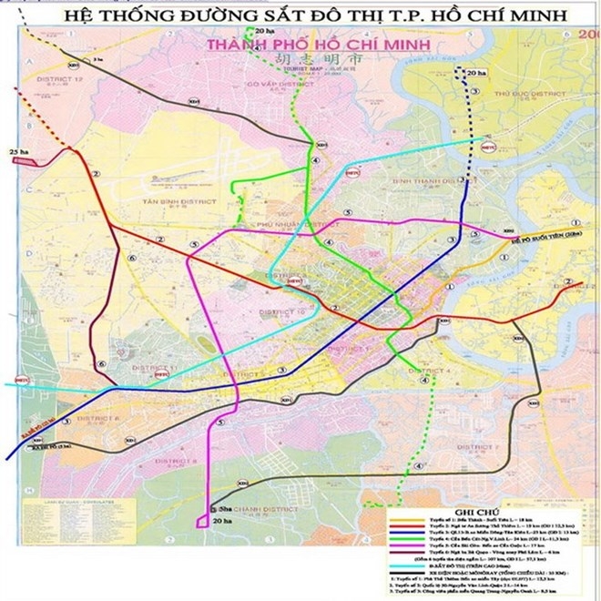
| Ho Chi Minh City metro project map (Source: baoxaydung.com.vn) |
The PM assigned the Minister of Planning and Investment as the Chairman of the State verification council to select the consulting unit, while gathering ideas of other ministries to maximise the effectiveness and economise the hiring.
The Metro line 5, spanning from the new Can Giuoc coach station to Sai Gon bridge, has a total length of 26 kilometres.
In the first phase, an 8.9km section will be built from Bay Hien crossroad in Tan Binh district to Sai Gon bridge.
The line has a total investment of 1.562 billion EUR and an implementation time from 2009 to 2027.
Under its design, the Metro line 5 will connect with line 2 at Bay Hien crossroad, line 4 at Phu Nhuan crossroad in Phu Nhuan district, Tan Son Nhat airport terminal in Tan Binh district, line 3b at Hang Xanh station in Binh Thanh district and line 1 at Sai Gon bridge station in Binh Thanh district.
HCM City’s metro project was the first proposed in 2001 as part of a comprehensive public transport plan for the city and neighbouring provinces to tackle traffic congestion.
It includes three monorail lines with a total length of 37km and six partly underground metro routes running a total of 107km from Ben Thanh to Suoi Tien, Ben Thanh to Tham Luong, Ben Thanh to Binh Tan, Lang Cha Ca to Van Thanh, Thu Thiem to Can Giuoc and Ba Queo – Phu Lam. Ben Thanh will be a hub connecting all the lines.
According to initial estimates in 2007, total investment of the project was 17 trillion VND (about 749 million USD). However, a recent calculation of Japanese consultant joint venture, verified by a Singaporean independent consultant unit, showed the total cost will be 47 trillion VND (2.07 billion USD). So far, 51 percent of the project’s workload has been completed and the project is scheduled to be finished in 2020.
What the stars mean:
★ Poor ★ ★ Promising ★★★ Good ★★★★ Very good ★★★★★ Exceptional
Related Contents
Latest News
More News
- PM urges Ho Chi Minh City to innovate and remain Vietnam’s economic locomotive (November 26, 2025 | 15:29)
- Experts chart Vietnam's digital finance path: high hopes, high stakes (November 14, 2025 | 10:56)
- Vietnam’s seafood imports surge 30 per cent in first 10 months (November 10, 2025 | 19:35)
- Vietnam’s durian exports hit $1 billion milestone (October 30, 2025 | 17:41)
- Beyond borders: Sunhouse and new era of Vietnamese brands on Amazon (October 28, 2025 | 10:46)
- Record-breaking trade fair set to open in Hanoi (October 15, 2025 | 15:59)
- Timber sector seeks solutions to VAT refunds (October 14, 2025 | 18:58)
- Tether explores investment prospects in Vietnam’s digital asset sector (October 10, 2025 | 18:09)
- Vietnamese investors pour nearly $847 million into overseas markets in nine months (October 08, 2025 | 18:42)
- Vietnam amends Law on Civil Aviation to create drive airport investment (October 03, 2025 | 18:29)

 Tag:
Tag:


 Mobile Version