Hanoi develops digital traffic map to ease congestion
 |
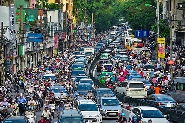
| Illustrative image (Photo: VNA) |
A document detailing the plan was submitted to the municipal People’s Committee for approval.
The system, which will cost 2 billion VND (86,700 USD), uses data from traffic cameras across the city. Servers for the system will be installed at the Hanoi Transport Management and Operation Centre (TRAMOC) on Kim Ma Street, Ba Dinh district.
According to the department, given the frequent congestions in the capital city, the use of information technology to build a digital traffic map will help drivers identify the optimal route to get to their destination.
Apart from providing its users with information about traffic infrastructure and vehicles, gas stations, medical stations and tourist attractions, the map will show route to the nearest site where the driver want to reach. It will also provide update on traffic flow and issue warning about possible congested areas.
Data on parking lots, coach stations, drop-off and pick-up points for coach buses will also be available on the map.
Earlier, the Ministry of Transport ordered competent authorities to accelerate the establishment of the digital transport map.
Pham Duy Ninh, Director of the Ministry of Transport’s Information Technology Centre, said demand for a digital map in the transport sector is high. There is no standardised digital map system for the sector, so transport units use a variety of digital maps, which results in the quality of information.
What the stars mean:
★ Poor ★ ★ Promising ★★★ Good ★★★★ Very good ★★★★★ Exceptional
Latest News
More News
- Congratulations from VFF Central Committee's int’l partners to 14th National Party Congress (January 25, 2026 | 09:46)
- List of newly-elected members of 14th Political Bureau announced (January 23, 2026 | 16:27)
- 14th Party Central Committee unanimously elects To Lam as General Secretary (January 23, 2026 | 16:22)
- List of members of 14th Party Central Committee announced (January 23, 2026 | 09:12)
- Highlights of fourth working day of 14th National Party Congress (January 23, 2026 | 09:06)
- Press provides timely, accurate coverage of 14th National Party Congress (January 22, 2026 | 09:49)
- Press release on second working day of 14th National Party Congress (January 22, 2026 | 09:19)
- Minister sets out key directions to promote intrinsic strength of Vietnamese culture (January 22, 2026 | 09:16)
- 14th National Party Congress: Renewed momentum for OVs to contribute to homeland (January 21, 2026 | 09:49)
- Party Congress building momentum for a new era of national growth (January 20, 2026 | 15:00)

 Tag:
Tag:


 Mobile Version