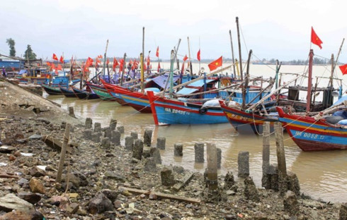
Localities urged to brace for upcoming storm
 |
Thang, who is also permanent deputy head of the Central Steering Committee for Natural Disaster Prevention and Control, asked ministries, agencies and localities to closely watch the movement of the storm and alert vessels to seek shelters or sail out of dangerous areas.
The storm is likely to make landfall from the central province of Thanh Hoa to Ha Tinh on the July 16 evening and July 17 morning, causing downpour in the north and north central regions.
The provinces of Thanh Hoa, Nghe An and Ha Tinh were urged to evacuate residents to higher places and ensure the safety of wharves and tourist areas before 5pm on July 16.
The media must update the latest movement of the storm and popularise skills to respond to the storm as guided by the committee.
According to the National Hydro-meteorological Forecasting Centre, the storm was located nearly 370km east-southeast of Thanh Hoa - Ha Tinh waters at 10am on July 16, with wind speed reaching 75-90km per hour.
In the next 12-24 hours, it will be moving north-northwest at a speed of around 20km per hour. By 10 pm on July 16, the storm will stay in the waters of Thanh Hoa and Ha Tinh provinces.
In the next 24-48 hours, the storm will continue moving in the north-northwest direction at a speed of 15-20km per hour, hitting the mainland of the two central provinces and weakening into a tropical low pressure.
Landslide and inundation are likely to hit the provinces of Lai Chau, Dien Bien, Son La, Hoa Binh, Lao Cai, Yen Bai, Ha Giang, Tuyen Quang, Thai Nguyen, Bac Can, Cao Bang, Lang Son, Quang Ninh, Thanh Hoa, Nghe An and Ha Tinh.
Flooding is also forecast in urban areas in Ha Noi, Hai Phong, Thai Binh, Nam Dinh, Hai Duong, Hung Yen, Thanh Hoa, Nghe An and Ha Tinh.
What the stars mean:
★ Poor ★ ★ Promising ★★★ Good ★★★★ Very good ★★★★★ Exceptional
Latest News
More News
- Congratulations from VFF Central Committee's int’l partners to 14th National Party Congress (January 25, 2026 | 09:46)
- List of newly-elected members of 14th Political Bureau announced (January 23, 2026 | 16:27)
- 14th Party Central Committee unanimously elects To Lam as General Secretary (January 23, 2026 | 16:22)
- List of members of 14th Party Central Committee announced (January 23, 2026 | 09:12)
- Highlights of fourth working day of 14th National Party Congress (January 23, 2026 | 09:06)
- Press provides timely, accurate coverage of 14th National Party Congress (January 22, 2026 | 09:49)
- Press release on second working day of 14th National Party Congress (January 22, 2026 | 09:19)
- Minister sets out key directions to promote intrinsic strength of Vietnamese culture (January 22, 2026 | 09:16)
- 14th National Party Congress: Renewed momentum for OVs to contribute to homeland (January 21, 2026 | 09:49)
- Party Congress building momentum for a new era of national growth (January 20, 2026 | 15:00)


 Mobile Version